Protected areas are a vital tool for safeguarding marine wildlife, but seabirds and other marine species often travel beyond these havens.
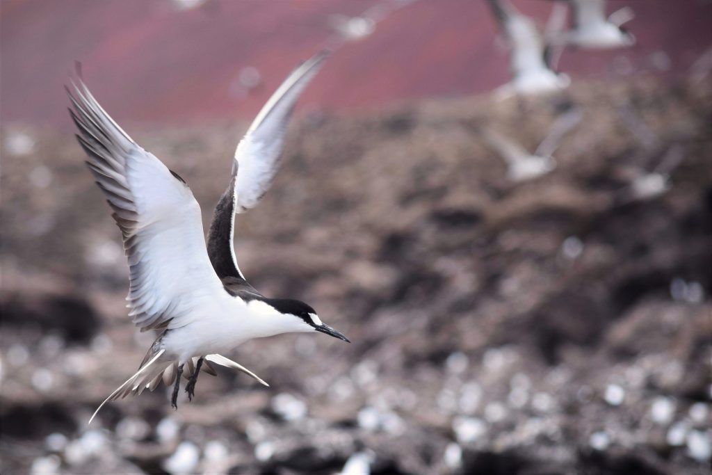
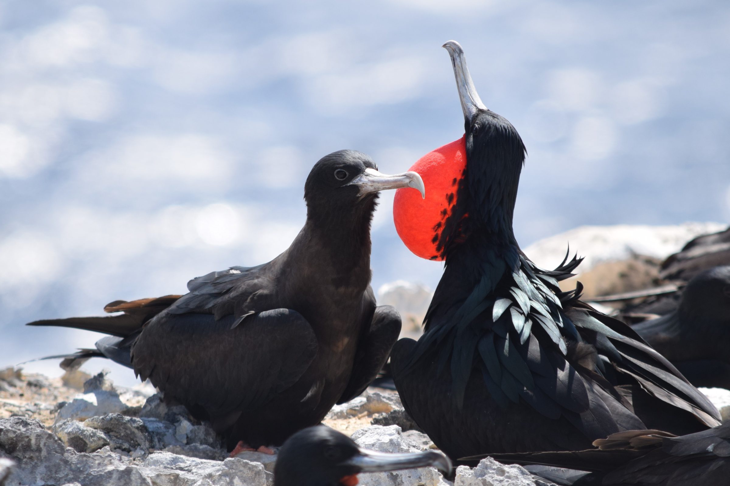
Ascension Island supports a very large Marine Protected Area covering the entire 200 nautical mile Exclusive Economic Zone (EEZ) radius around the island, where industrial fishing is banned. However, previous tracking studies have shown that some of Ascension’s seabirds, travel outside the Marine Protected Area on a regular basis. These include the Sooty Tern, Masked Booby and endemic and Vulnerable Ascension Frigatebird.
Protecting Seabirds Across Borders
The BirdLife International marine science team is working on a project led by Ascension Island Government’s Conservation and Fisheries Directorate to understand how much the island’s seabirds travel outside of the protected zone and to what extent they are exposed to fishing activity. High Seas fishing presents a threat to wide-ranging seabirds in terms of bycatch and overfishing. In the tropics, many seabirds rely on sub-surface predators, including tuna, sharks, swordfish and dolphins to push fish to the surface so that the birds can reach them. Overfishing, and illegal, unreported and unregulated fishing for oceanic predators is a threat to seabirds that forage in this way.
Protection outside the exclusive economic zones of countries is limited, but with the High Seas Treaty on the horizon, there is an increased focus on addressing these impacts.
Understanding the “Lost Years”
In general, most seabird tracking work has been on breeding adults as they are the most accessible and devices can be recovered when birds return to the nest to either take turns incubating or feed their chicks. This leaves a big gap in our knowledge – where do birds go after they fledge and before they return to the breeding colony for the first time – known as “the lost years”. This project is filling the gaps by tagging recently fledged birds with specialist satellite trackers that transmit the data live so they do not require recovery.
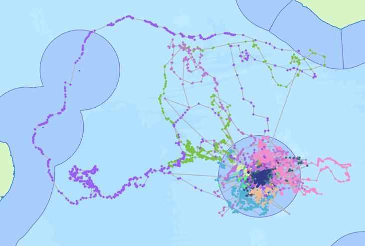
Our new tracks from juvenile Ascension Frigatebirds show they are travelling vast distances!
(Dark blue = Exclusive Economic Zones).
Next Steps
More satellite tags are ready to be deployed from Ascension as soon as the chicks are ready to depart on their first journeys. Using existing data (some collected by BirdLife Partner RSPB and the University of Exeter) and the new data gathered in the project, we will investigate the overlap between bird locations and hotspots of industrial fishing activity. We are working with Centre for Environment, Fisheries and Aquaculture Science (CEFAS), Global Fishing Watch (GFW) and the Marine Management Organisation (MMO) to understand the distribution of fishing effort in the areas visited by tracked birds from Ascension.
We are also investigating existing seabird tracks from Ascension’s closest neighbour – St Helena (“only” 1300 km away), including for Red-billed Tropicbirds and Band-rumped Storm-petrels, with the help of the St Helena Government.
The results will help engage with Regional Fisheries Management Organisations and guide priorities for conserving seabirds and the marine environments they inhabit, not only within the borders of current marine protected areas, but across vast oceans.
We are looking forward to seeing where the birds go to next!
The Protecting Seabirds Across Borders project (DPLUS195) is funded by the UK Government Biodiversity Challenge Funds through Darwin Plus, and additional satellite tags were funded by the Blue Belt Programme.